Description
Product Description
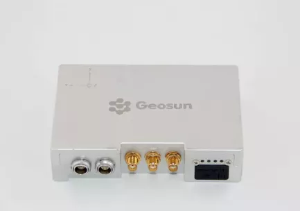
GPS BDS GLONASS GNSS INS System For Positioning And Altitude
AGS 300 GNSS INS System adds a high-precision inertial navigation (IMU) module, no matter how the fuselage tilts during the aviation flight, it can accurately provide position, velocity and 3D attitude information.
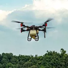
After the data processing of professional software, AGS 300 provides threedimensional position accuracy of 0.05 m, velocity of 0.02 m/s, heading of 0.080 degree, and pitch/roll of 0.030 degree, data sampling rate ups to 200Hz. With AGS 300, UAV Aerial remote sensing can completely be free from ground control point, it is especially applied to the UAV surveying in strip area, irregular shape area, large watershed area and high latitude area; and is also widely used in UAV laser scanning and other direct geo-reference aerial remote sensing fields. For the users who required high-precision and real-time in precision agriculture, electricity and other areas, AGS 300 also offers GNSS real-time differential positioning (RTK) function.
- UAVs
- unmanned and accessories
- radar
- hardware
- navigation
Production Capacity:
Not informed
Delivery Timeframe:
Depends on Size of Order
Incoterms:
Not informedPackaging Details:
Not informed
More about
Shenzhen Nuobashi Trading Co.,Ltd
10-50
Employees
Not informed
100%
% Export sales
Year
Established
Business type
- Industry / Manufacturer
- Distributor / Wholesaler
Keywords
- Semiconductors
- automotive diagnostics
- drones
- oscilloscopes
- electronic components
Contact and location
-
Weili ********
-
+86 1********
-
深圳 / | China


